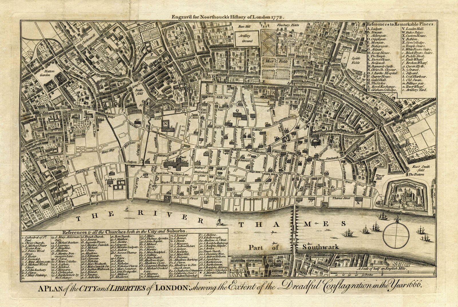
FIRE OF LONDON – A PLAN OF THE CITY AND LIBERTIES OF LONDON 1666
$26.1
$37.06
✶✶✶ Unique Old Map Reproduction ✶✶✶LONDON, 1772 – A Plan of the city and liberties of London, showing the extent of the Dreadful Conflagration in the Year 1666.The excised detail leaves a clear outline of the streets of the seventeenth century City, and the principal sites and buildings are given in keyed indices. The map is based on an earlier map by Wenceslaus Hollar, and was originally produced for John Noorthouck’s part-work “A New History of London†(London: 1772-1773).Engraved for Noorthouck’s History of London 1772. Printed for R. Baldwin, 47, Pater-Noster Row. 1773. Taken from “A New History of London, Including Westminster and Southwark, to which is added, A General Survey of the Whole; Describing The Public Buildings, Late Improvements, &c.Illustrated With Copper-Plates.†by John Noorthouck. London, 1773. Includes “References to all the Churches both in the City and Suburbs†and “References to Remarkable Placesâ€. YEAR: 1666 of London and its environs, extending to Amersham, Hertford, and Chelmsford in the north, and to Guildford, Reigate, and Tonbridge in the south. YEAR: c.1772CARTOGRAPHER: Bartlett W