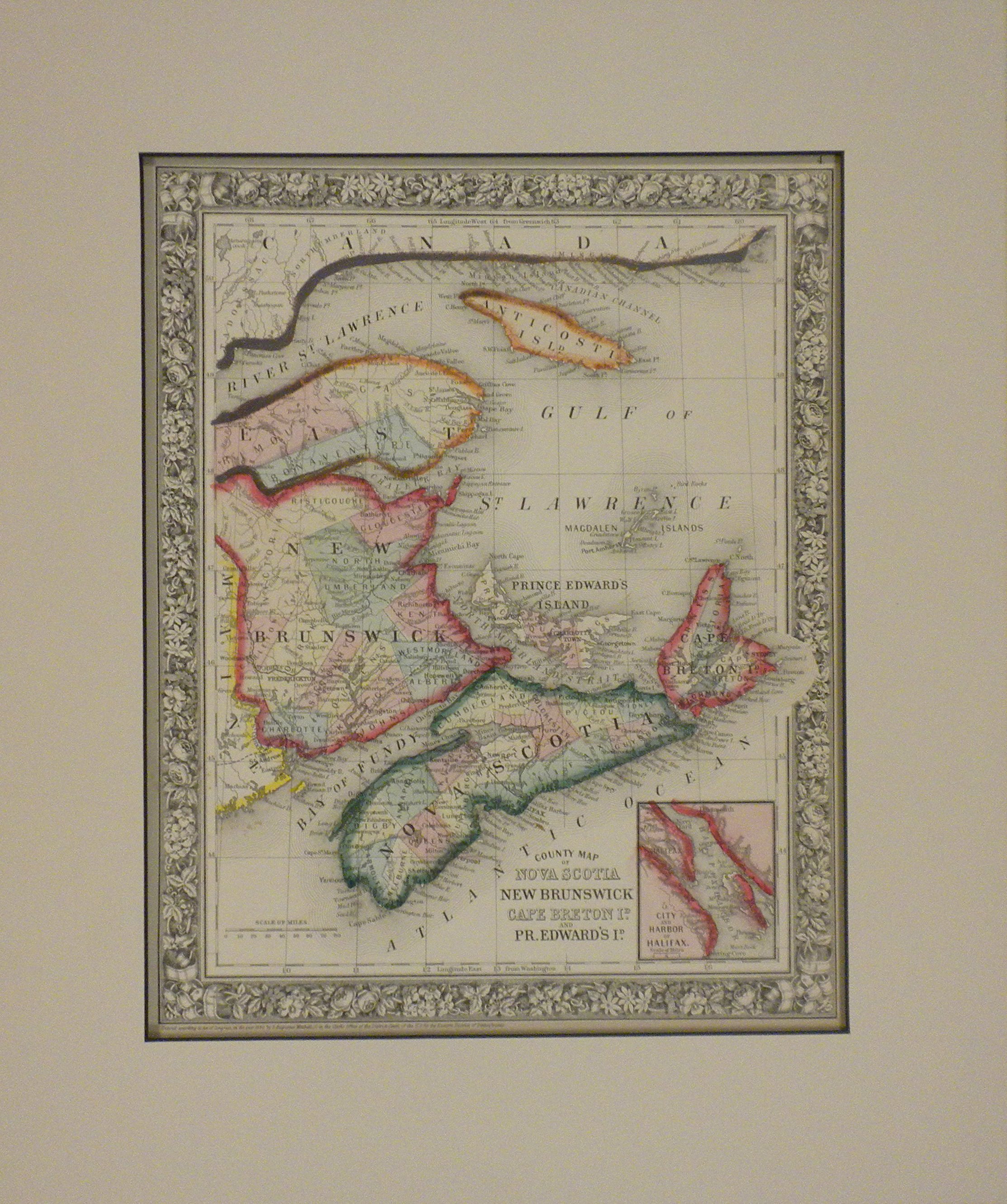
1859 Map of New Brunswick and Newfoundland, Canada by J. H. Colton
$64.98
$97.47
History of J. H. Colton Maps Joseph Hutchins Colton (July 5, 1800 – July 29, 1893), known professionally as J. H. Colton, founded an American mapmaking company which was an international leader in the map publishing industry between 1831 and 1890. Colton was born in Longmeadow, Massachusetts, and moved to New York in 1831 to establish his firm. For the first ten years, Colton licensed the use of maps from established engravers such as Samuel Stiles and David H. Burr. Colton went on to create railroad maps, immigrant guides, folding pocket maps, large wall maps, and elaborate atlases. J. H. Colton Company maps were printed using engraved steel plates, which produced higher quality prints than maps made with less costly wax engravings. They were often individually hand water-colored and were recognized for their decorative borders. In the early 1850s Colton brought his two sons into the business, George Woolworth Colton (1827–1901) and Charles B. Colton (1832–1916). In 1857, Colton was awarded a $25,000 commission by the Government of Bolivia to produce 2500 large maps of the country. Colton completed the contract, but was not paid by Bolivia, which was mired in revolution. Colton pursued a high-profile legal case against the Bolivian and Peruvian governments and after considerable delay was awarded $100,000 in compensation and damages. Maps published by J. H. Colton can be found in the historical archives of most of the U.S. states, (including Mississippi, Louisiana, and Maryland) and of many national governments (including the United States Library of Congress). They are also found in university and museum collections (including at University of Kansas, University of Texas, and Princeton University).